Determining the exact boundaries and dimensions of the land is one of the most important steps in real estate transactions, construction, land separation, receiving the document and doing registration. In many properties, the information included in the old documents differs from the current state of the land, and this issue can lead to disputes between the owner and neighbors or cause problems in administrative processes. Accurate mapping to determine the boundaries and dimensions of the land in Rasht helps the owner determine the real location of the property, the length of the sides, its area and coordinates with engineering precision.
What is accurate mapping to determine the boundaries and dimensions of the land?
Precise mapping to determine the limits and dimensions of the land is an engineering process during which the location of different points of the property, corners, sides, existing complications and, if necessary, the exact coordinates of the land are taken. After being processed by specialized software, the collected information is converted into a map so that the dimensions and area of the land can be checked accurately.
In this process, it is not just about measuring the length and width of the land; Rather, the geometrical position of the property in relation to the surrounding complications and the information in the documents can also be examined. For this reason, land mapping should be done by a person or a group who is familiar with the principles of data collection, data processing, and preparation of engineering maps.
In registration projects, the separation map is also used to specify the boundary and privacy, dimensions and area of the property and its location.
Why is it important to determine land boundaries in Rasht?
Lands located in Rasht may have different conditions in terms of plot shape, building condition, access, adjacent properties and registration information. For this reason, it is not possible to determine the true boundaries of a land based on approximate measurements or oral information.
Determining land boundaries in Rasht can be used in different cases; Including:
- Purchasing and selling land
- Checking the real area of the property
- Disaggregating the land
- Integrating parts
- Construction
- Receiving the document
- Correcting property information
- Checking border disputes
- Preparing a UTM map
- Positioning the property
- Municipality related matters
- Preparing a map for administrative processes and Registration
- Implementation of property boundaries on land
In such a situation, accurate mapping makes the technical information of the property clear before taking the next steps and making decisions based on the measured data.
The importance of accurate calculation of land dimensions
One of the most important outputs of mapping is determining the exact dimensions of the land. The length of each side, the geometric shape of the plot and the final area can influence many decisions related to the property.
For example, the owner may think that the land has a certain area, but after the engineering survey it is determined that its actual dimensions are different from the initial information. This difference can be caused by the irregular shape of the land, changes made in the range, mistakes in old measurements or differences between the status of the document and the existing status.
As a result, accurate mapping to determine the limits and dimensions of the land in Rasht can provide the owner with the necessary technical information before actions such as separation or construction.
Detailed land mapping steps in Rasht
Check documents and property information
In the first step, the available information about the land is checked. Ownership document, sketch, previous maps, registration information and other relevant documents can be effective in the initial recognition of the property.
This step is very important; Because the surveyor must know the purpose of the harvesting operation and what information should be extracted from the ground.
Site visit
After checking the basic information, a field visit to the property is done. At this stage, the existing condition of the land, visible borders, walls, buildings, passages, natural and artificial complications and other important points are examined.
Taking the points and corners of the land
Important points of the property are taken with appropriate mapping equipment. The accuracy of this step directly affects the quality of the final map. The more accurately the points are taken, the more reliable the dimensions and area calculations will be.
Processing of collected data
The collected information is entered into specialized software. At this stage, the collected points are arranged and the geometric relationship between them is determined.
Drawing a map of the earth
After processing the data, a map of the existing situation or a map of the project is prepared. In this map, you can display the limits of the piece, the length of the sides, the area and other required information.
Final control of information
Before delivering the map, the information drawn and drawn should be controlled to reduce possible errors. This control is more important for projects where the map is to be used in administrative, registration or construction processes.
The role of the UTM map in determining the location of the earth
One of the important terms in real estate mapping services is UTM map. The UTM map shows the location of the property based on specific coordinates in the relevant coordinate system and can be used for some registration and administrative purposes.
In real estate mapping services, determining UTM coordinates, placing a registration plate, and specifying property boundaries are among the well-known applications of registration mapping.
For this reason, if the owner's goal is accurate mapping to determine the limits and dimensions of the land in Rasht to prepare a map for a registration or administrative process, the type of map needed should be specified from the beginning.
Determining the boundaries of the land based on the document
One of the important things in real estate mapping is to compare the information of the document with the existing condition of the land. In some properties, especially properties with old documents, determining the exact location of the property boundaries may require checking the registration information and existing taxes.
In the specialized process of placing the registration plate, the information of existing documents and fees can be used to determine the real location of the property.
For this reason, if the boundaries of the land are not known to the owner, simple measurement with a meter or visual estimation cannot replace mapping engineering operations.
Application of mapping in buying and selling land
Before buying or selling land, it is very important to know the real area and boundaries of the property. The buyer usually needs information such as the area, dimensions, shape of the land and its location in order to better evaluate the property.
Carrying out accurate mapping to determine the limits and dimensions of the land in Rasht before the transaction can provide appropriate technical information about the condition of the property. This is especially important for large plots of land, irregular plots or properties that do not have clear boundaries in place.
Of course, mapping alone is not a substitute for legal and registration checks of the transaction, and in real estate transactions, it is better to check the status of the document, ownership and legal restrictions by the relevant authorities and experts.
Mapping for land separation
Terrain separation is another thing that requires accurate geometric information. When the owner intends to divide a piece into several parts, the dimensions and area of the main piece and the desired parts must be known.
Mapping can provide the basic information needed to draw parts and check their dimensions. In the specialized services of separation map, the determination of boundaries, area and location of the plot is one of the main goals of preparing these maps.
Land mapping for construction
Before starting a construction project, knowing the land accurately is very important. The location of the building, the dimensions of the land, the boundaries of the property and the height situation can be effective in the design and implementation stages of the project.
In Rasht, choosing an expert team for land mapping for construction can help prepare more accurate information for the next steps. In construction projects, mapping is also used to implement points, control the position of structural elements and check the status of project implementation.
Mapping for property boundary disputes
One of the important uses of mapping is to investigate disputes related to the border between two properties. Engineering information can be used to clarify the situation when neighboring property owners disagree about the exact location of a boundary or the extent of a property's frontage.
In this situation, the surveyor first checks the available information and then takes the situation of the place. If needed, document information and previous maps are also checked to specify the issue more technically.
Why is accuracy important in mapping?
A small error in picking a point may affect the final calculations. This issue becomes more important in large plots or projects where property boundaries are very important.
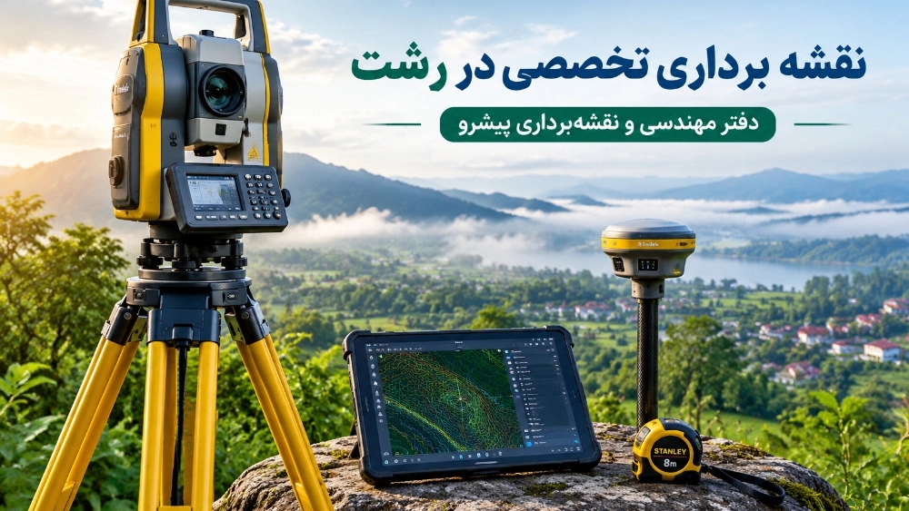
Accurate mapping to determine the boundaries and dimensions of land in Rasht should be done based on the principles of sampling, correct use of equipment, data control and proper processing. The use of mapping equipment such as GNSS receivers and precision measuring equipment, depending on the type of project, can be effective in increasing the accuracy of the survey.
In some technical projects, raw data collected with GNSS or mapping cameras are used to document operations.
Services of the leading engineering office in Rasht mapping
Foreign Engineering Office, as a specialized group in the field of engineering and mapping services, can provide surveying and mapping services for owners who need detailed information about their land.
Focusing on accuracy in collecting information, checking the project conditions and preparing a plan according to the client's needs are among the things that are important in choosing an engineering office.
- Land mapping in Rasht
- Determining the boundaries of the property
- Determining the dimensions of the land
- Calculating the area of the land
- Preparing the UTM map
- Detecting the existing situation
- Positioning the property
- Registered mapping
- Building mapping
- Preparing maps for administrative affairs
- Detecting points and corners Land
- Establishment of property boundaries
- Control of land dimensions
- Mapping for separation
- Mapping services related to construction
Choosing the type of service should be done based on the purpose of the project, the available documents and the requirements of the authority receiving the map.
Advantages of using professional mapping services
Using the services of a specialized collection can make the process of taking and preparing the map more regular. Its most important advantages are:
Increasing the accuracy of property information
Professional measurement makes it possible to prepare information on the dimensions and area of the land based on the collected data.
Reduce the possibility of differences in approx
When the boundaries of the land are known with engineering information, it will be easier to check possible differences between adjacent properties.
Preparing information for the next steps
Mapping information can be used in design, construction, separation and some administrative projects.
Save time
Principle collection and proper processing of data can avoid repeated measurements and unnecessary corrections.
Better decision making for the owner
When the owner knows the dimensions, area and location of the land more accurately, he can plan more accurately for the use of the property, construction or other related actions.
When do we need accurate land mapping?
If any of the following conditions apply to your property, it may be helpful to consult with a professional surveyor:
- You intend to buy land.
- You want to sell the land.
- The actual area of the land is not clear to you.
- The boundaries of the land with neighboring properties are unclear.
- You intend to separate the land.
- You need detailed information about the property for construction. You have the property.
- There is a dispute about the dimensions or boundary of the property.
- You need a detailed map for an administrative process.
The difference between conventional measurement and engineering mapping
At first glance, measuring the land with a meter or simple tools may seem sufficient, but engineering mapping is more than measuring polygons.
In professional mapping, the location of the points, their geometric relationship, the coordinate system, the shape of the land, the existing complications and the final goal of the project are considered. Then the collected information is processed and converted into a map.
For this reason, for projects where the map is to be used in registration, construction or administrative affairs, it is better to have the operation done by an expert.
Choosing the leading engineering office for mapping in Rasht
Choosing the right set for accurate mapping to determine the boundaries and dimensions of the land in Rasht should be done according to the type of project, work history, equipment, expertise of the forces and the type of services required.
Foreign Engineering Office, focusing on engineering and mapping services, can be an option for owners who need accurate land surveying and preparation of property technical information to receive expert advice and services.
Before starting the project, it is better for the owner to provide the existing documents, documents, previous maps and the purpose of the mapping to the engineering office. This work helps the expert to specify the type of drawing and map needed more precisely.
The cost of accurate mapping to determine the boundaries and dimensions of the land in Rasht
The cost of accurate mapping to determine the boundaries and dimensions of land in Rasht is not the same for all projects. Factors such as the area of the land, the shape of the plot, the number of points required for sampling, access conditions, the type of equipment, the purpose of mapping, the need for a UTM map or other specialized maps, and the status of property documents can affect the final cost.
For this reason, announcing the exact price without checking the project specifications may cause an incorrect estimate. The best way is for the owner to provide the basic information of the land so that the required services and cost are determined according to the project.
Important points before ordering land mapping
Before starting work, it is better to specify the following:
- What is the main purpose of mapping?
- Is the title deed available?
- Is there an old map or sketch?
- What is the approximate area of the land?
- Does the land have a defined wall or boundary?
- Is there a dispute with the adjacent property?
- For what reference is the map prepared?
- Is a UTM map required? Is it?
- Is the land going to be divided?
- Is the map used for construction?
Answering these questions will help the surveyor to determine the required services more precisely.
summary
Precise mapping to determine the boundaries and dimensions of land in Rasht is one of the important services for knowing the geometrical and spatial condition of properties. Accurate determination of corners, sides, area and location of land can be used in transactions, construction, separation, registration and many real estate processes.
In situations where there is a discrepancy between the document information and the existing condition of the land or the owner needs more detailed information about the property, the engineering survey can provide valuable technical information. Preparation of UTM map, survey of existing situation and determination of property boundaries are also services related to property mapping.
The leading engineering office in Rasht can be with owners and employers in the field of mapping services and providing technical information needed for projects. To choose the right type of map and services, it is very important to check the property documents and the final goal of the project. If you need to accurately determine the boundaries, dimensions, area or location of your land, getting expert advice before starting the operation can make the path of doing the work clearer.