What is Mapping?
Mapping is a branch of engineering science that deals with the collection, preparation, storage, processing, management, analysis, integration, retrieval and transmission of reference location data. Mapping is taught as a subgroup of engineering sciences in the country's universities. This field is placed as 2 units or more in some other fields as a partial introduction.

Types of mapping
Mapping is divided into 2 main categories and several subcategories. One main category includes general and applied mapping and the other category is specialized and engineering. Specialized mapping and engineering are collected for planning and designing engineering works such as roads, bridges and reservoirs.
Types of General and Practical Mapping:
Map or Cartography (Cartography):
Mapping or cartography is the science and art of drawing earth maps. In a general sense, all mapping operations are also called cartography.
Topographic or topographic complications:
Receiving and displaying the physical form of the earth, including all its lows and highs, such as mountains, valleys, rivers, etc., as well as calculating the area and height.
Planimetry: Planimetry:
In this type of mapping, the aim is to show the flatness of complications And the height of the points and low and high points are not taken into account. The maps obtained in this branch are also called plans; Like the plan of a park and similar things.
Hydrography (Hydrogram):
Includes the preparation of map and location data of water depth in order to have the position of the depth of seas and rivers. From it to determine M.S.L (mean sea level), water spread area, water depth, flow speed in streams, flow cross-section, direction of passage of ships, submarines, place of passage of oil and gas pipelines from deep seas, creation of wharf new and mechanized,... is used.
Cadastre or cadastre (cadastre):
Cadastre is a type of registration mapping that has legal value and ownership documents can be issued based on its boundaries. Cadastre is the main source of data in disputes and lawsuits between land owners. The set of activities related to land surveying includes the preparation of maps using terrestrial, marine, aerial, and satellite photos and images, digital conversion of photos and images, ground mapping operations, editing and completing land maps, and matching the map with the real and existing state of properties and adding all Registration, legal and descriptive information and its final control and update.
Types of Specialized Mapping and Engineering:
Photographer or Photographer (Photograms):
The knowledge and technology of extracting information related to the earth and its surrounding environment from captured images or other sensors through measuring, processing, analyzing and displaying them. In other words, imaging is the process of measuring the geometric coordinates of objects from aerial photographs, and it is the art, knowledge, and technique of providing correct information about complications through measurement, recording, and interpretation on photographs or other documents that contain a trace of reflected electromagnetic energy. be.

Geodesy (Geodesy):
It is a branch of applied mathematics and earth sciences that deals with measuring and displaying the shape and dimensions of the earth, determining the exact position on it, and investigating the earth's gravity field and its temporal changes. Geodeticians (land surveyors) study geodynamic phenomena such as earth crust movements, tides and polar movement. Geodesy is part of the curriculum of the mapping engineering field of universities.
Fasting or Tacoometry (Takeometry):
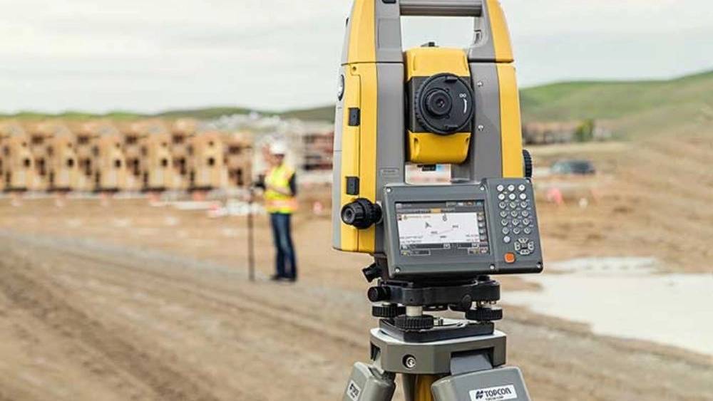
A branch of surveying in which horizontal and vertical distance is determined by making angular observations with an instrument known as a tachometer. A tachometer is nothing but a portable theodolite equipped with a stadia diaphragm and an analytical lens. In this mapping method, there is no need to measure the distance. The principle of the tachometric method is based on an isosceles triangle in which the ratio of the distance between the base and the apex and the length of the base is always constant.
Geographic Information System (Geographic Information System):
Returns or Durkawi (Rs):
The knowledge and technique of collecting information from objects on the surface of the earth, without physical presence in the place. Remote sensing involves measuring and recording reflected energy from the earth's surface and its surrounding atmosphere from a suitable point above the earth's surface. Reflected rays, which are electromagnetic waves, can have various sources such as solar rays, thermal rays of objects or even artificial rays.

